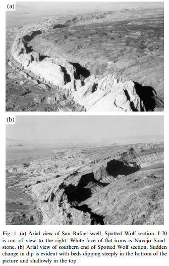
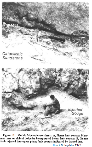
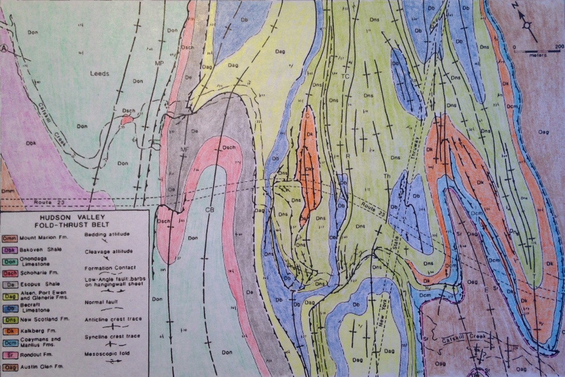
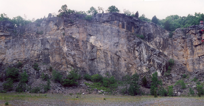
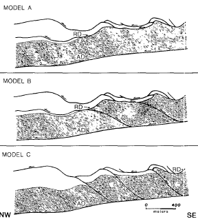
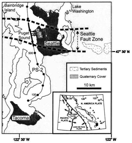
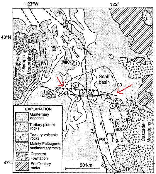
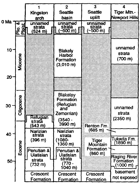
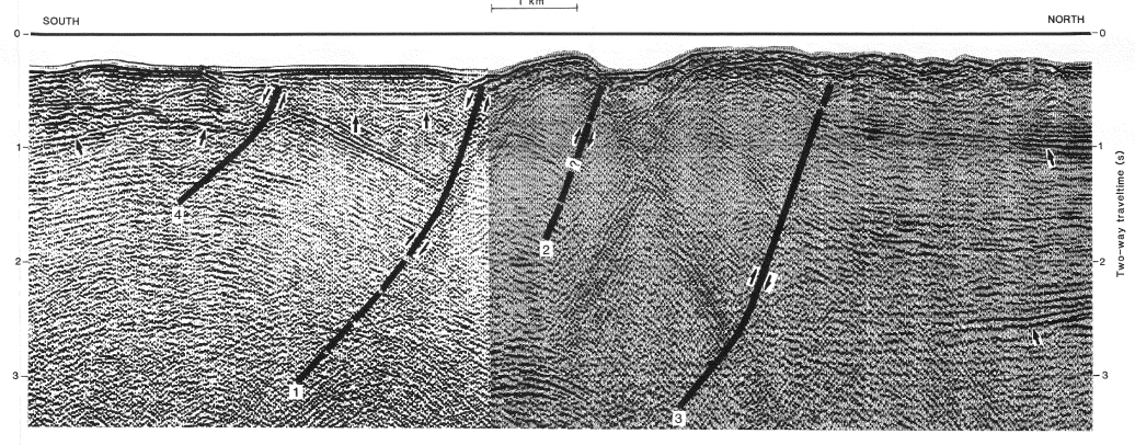
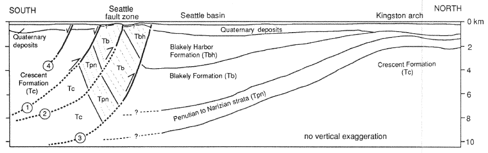
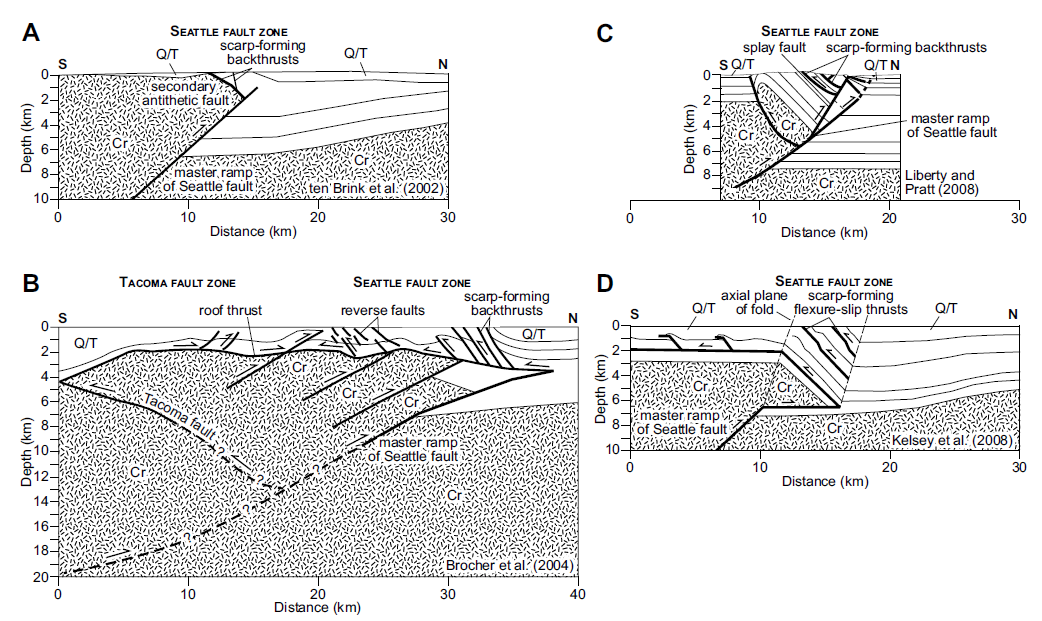
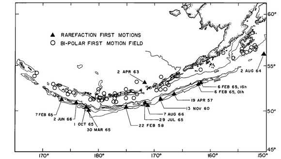
 |
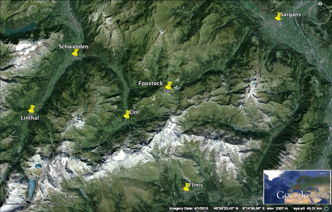
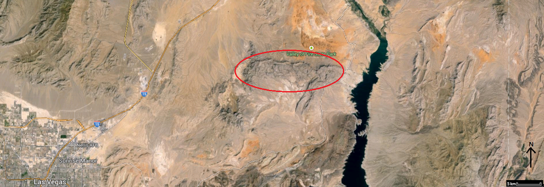
Figure 1 (left) shows the location of Glarus fault in google maps. Figure 2 (right) shows a zoomed satellite view on the region in which the Glarus fault is located.
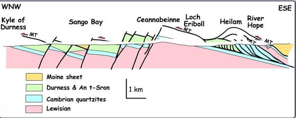
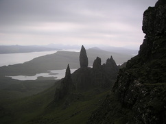
The Swiss Alps are both magnificient and impressive, luring lots of tourists every year. Apart from drawing tourists, this fairly new mountain range also attracts many geologists. A distinct line (as seen in Figure 5) seperating two rock layers outcrops at numerous locations in the Swiss Alps; this is known as the Glarus Overthrust Fault. The Glarus Thrust is located in the eastern part of the Alps of Switzerland. The thrust is exposed over a large area in the Canton of Glarus, St. Gallen and Graubünden regions.
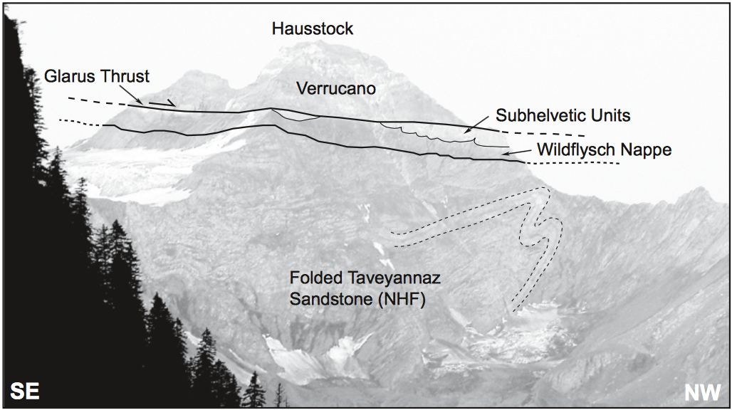
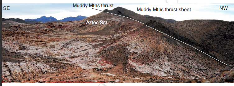
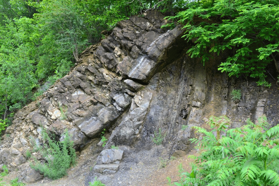
Figure 3: Picture of the Hausstock peak, cleary showing a fault line and labeling different rock units (Gasser, Brok, 2008)
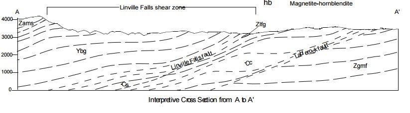
A thrust fault is simply a low-angle reverse fault, especially if that fault extends for several to hundreds of kilometers such as the Glarus Thrust (Fossen, 2010). Since a thrust fault dips at a low angle, it is possible for compression to push older rock sequences above younger ones. According to Herwegh et al., the Glarus Thrust dates back to the Oligocene-Miocene age, roughly 35 to 5 millions years ago. The fault separates the Glarus nappe from its footwall with a total displacement of at least 30 to 40 km (2006). As shown in Figure 3, the top of the Hausstock peak constitutes of Verrucano rocks, which form the base of the Helvetic Nappes. These rocks consists of rhyolitic and spilitic layered volcanic rocks, as well as red beds and conglomerates, dating back to the Permian (299 to 251 Ma) (Raumer, Neubauer, 1993). The Verrucano beds can be seen at the base of the Helvetic nappes in some areas but in others, can overlie folds and younger rock strata (Herwegh et al., 2006). The Helvetic Nappes and Subhelvetic Units, overthrust the Wildflysh Nappe and the North Helvetic Flysch (NHF), hence known as Infrahelvetic complex. The NHF consists mainly of turbiditic sandstones and slates dating back to the Early Oligocene (roughly 34 Ma) (Gasser, Brok, 2008). The Glarus fault is an important feature in the geological world because it is shows a very clear example of a thrust fault where the nappe contact is extremely clear and is also visible in three-dimensions. Furthermore is has played a role in the history of geology, as it was not always clear that thrusting was the answer to this phenomenon (Buckingham et al., 2013).
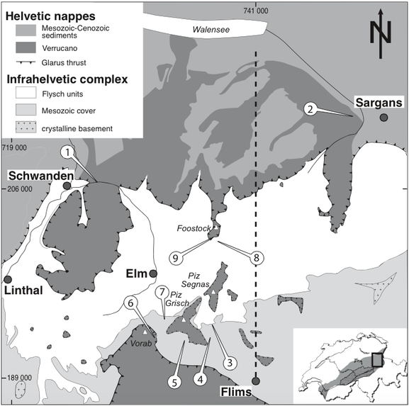
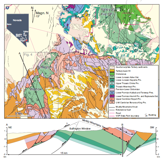
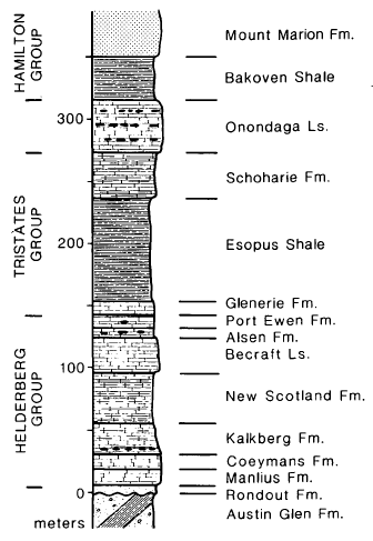
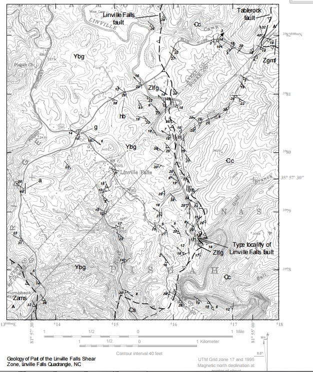
Figure 4: Geological map of the Glarus fault (Herwegh et al., 2006)
In the geological map of the Glarus Overthrust (Figure 4), the thrust line seems to somewhat follow the topography (circles around the peaks, observable even though the geological map does not include contour lines). This is caused by the fault dipping at a low angle. When the rock beddings are horizontal or nearly horizontal, their contacts will also be horizontal. Therefore, on a topographic map, the bedding contacts will run parallel to the contour lines (UOregon, 2010). This is also true for faults, explaining why the fault line seems to follow topography. On this map, the dark line with arrows is the Glarus fault line. The darkest layer is the Permian Verrucano rocks, while the white layer is the younger, Oligocene Flysch units. The Flysch Units in this map refer to the NHF as well as the Wildflysch Nappe. The flysch units contain many folds and other deformations. The map shows that the Helvetic Nappe, which contains the Verrucano rocks as well as Mesozoic-Cenezoic sediments, overlay the Infrahelvetic complex, which inclides the Flysch units, a Mesozoic cover and a crystalline basement. The older Helvetic Nappe overlays the Infrahelvetic complex along the thrust line, showing that the thrust fault was responsible for this displacement. The numbers on this map are irrelevant for the purpose of this text, they simply correspond to stops visited by Herwegh et al. in 2006.
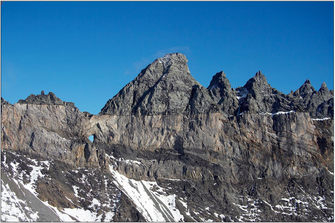 Figure 5: The Glarus Thrust seen from the Tschingelhorner region (Imper, 2011) | 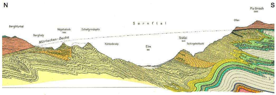 Figure 6: Profile of Glarus Thrust showing erosion of the overthrusted rock sequence (Verrucano) (Imper, 2011) |
In Figure 5, the Flysch rocks are the brownish rocks underneath the darker coloured rocks (Verrucano). As mentioned ealier, the Flysch rocks are sedimentary rocks and contain shale and sandstone. Also, in the Tschingelhorner region, a limestone level dating back between 100 and 150 ma can be identified between both rock layers. This limestone layer would have also been brought with the Verrucano rocks along the fault. Figure 6 shows the cross-section profile between Tschingelhorner and Charpf. The Verrucano rocks are exposed in the regions of Tschingelhorner and Charpf but are missing in the area in between (surroundings of Elm). This valley was formed by erosion, which is why the Verrucano rocks are missing. By looking at Figure 6, it is easy to observe that both of the Verrucano outcrops on either side are part of the same bed and would have been connected prior to erosion. The surrounding rocks around the Glarus fault are also caracterized by folds such as in the Flysch rocks (Imper, 2011).
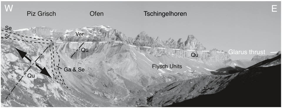
Figure 7: View of the Glarus Thrust in Tschingelhoren, showing thrusting as well as deformation in units (Herwegh et al., 2006)
The deformation that took place in the Infrahelvetic Complex occured in three phases. During the first phase, the Sardona and Blattengrat Nappes slid onto the NHF. The Sardona and Blattengrat Nappes consist of Late Cretaceous and Eocene limestones, marls and marine sandstones. This phase could have occured by gravity sliding. In the second phase, the Infrahelvetic Complex was subjected to folding. The third phase is the development of the Glarus Thrust. The Glarus thrust is an out-of-sequence thrust, where a minimum displacement of 35 km which formed a steep crenulation cleavage below the thrust. Another theory is that the Sardona and Blattengrat Nappes were not caused by gravity sliding but by compressional tectonics. This could have thrusted and folded the NHF Unit. Also this theory suggests that the Glarus thrust was first displaced between 25 to 30 km and was later followed by another 5 to 10 km displacement. The Infrahelvetic complex would have been folded during the first displacement and would have developed its steep crenulation cleavage during the second displacement (Gasser, Brok, 2008). Figure 3 shows an example of this folding in the NHF. Figure 7 shows the Verrucano rock layer thrusted over the Quinten Formation (Qu). Underneath the Ofen (middle), the Qu displays a large syncline fold with parasticic folds which have been destroyed by the Glarus Thrust. On the left of the picture, there is a large recumbent fold which consists of Mesozoic and Cretaceous sediments. There is also an alteration zone between some of the Verrucano and Flysh Units contacts that can be observed. This alteration zone was caused by the friction heat released when the thrust was displaced (Herwegh et al., 2008).
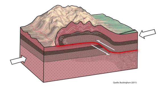
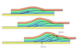
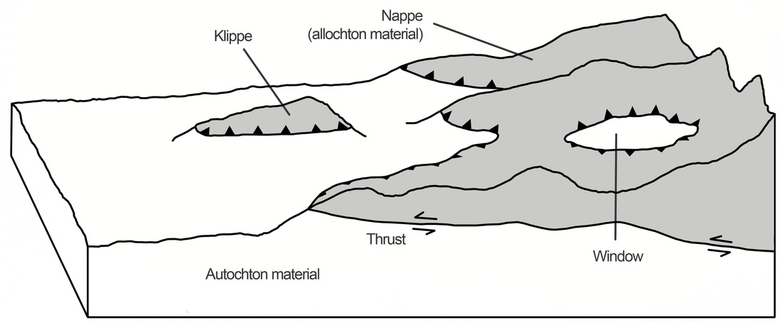
Figure 8: Schematic diagram of an overthrust formation (Buckingham et al., 2013)
According to Buckingham et al., the stress which caused the Glarus Oversthrust, was the formation of Alps. The Alpine Orogeny is thought to have been formed by two different orogenies; one during the Cretaceous and one during the Tertiary. The formation of the Alps was caused by the collison of the European continent and the Adriatic continent, after subducting the ocean basins in between, like the Tethys Ocean. There is still shortening in the eastern part of the Alps today (Froitzheim, 2012). The Glarus Thrust was formed during the second part of the orogeny. This collision caused enough stress to push the older rock layers (Verrucano), along the low-angle thrust fault, above the younger sequences. Figure 8 shows an example of how overthrusts are formed, causing older rocks to lie on top of younger ones. The large white arrows show the direction of compression. As the figure illustrates, the fault has to be dipping at a low-angle. If it was not, the compression would simple cause a reverse fault and this inversion in rock layers could not be observed.
References:
Buckingham, Thomas, Walker Simon, Jurg Meyer, and Harry Keel. "Swiss Tectonic Arena Sardona." Unesco World Heritage, v3.0. 7 Aug. 2013. Print.
Fossen, Haakon. Structural Geology. Cambridge: Cambridge UP, 2010. Print.
Froitzheim, Nikolaus. "Geology of the Alps Part 1: General remarks; Austroalpine nappes." Structural Geology. University of Bonn, Germany. 27 Mar. 2012. PDF.
<http://www.steinmann.uni-bonn.de/arbeitsgruppen/strukturgeologie/lehre/wissen-gratis/geology-of-the-alps-part-1-general-remarks-austroalpine-nappes>.
Gasser, Deta, and Bas Brok. "Tectonic Evolution of the Engi Slates, Glarus Alps, Switzerland." Swiss Journal of Geosciences 101 (2008): 311-22. Print.
Herwegh, Marco, Jean-Pierre Hürzeler, O. Adrian Pfiffner, Stefan M. Schmid, Rainer Abart, and Andreas Ebert. "The Glarus Thrust: Excursion Guide and Report of a Field Trip of the Swiss Tectonic Studies Group (Swiss Geological Society, 14.–16. 09. 2006)." Swiss Journal of Geosciences: 323-40. Print.
Imper, David. "Elm-Linthal: Crossing the Richetlipass." Federal Office of Topography Swisstopo. Swisstopo, 15 Feb. 2011. Web. 30 Mar. 2015. <http://www.swisstopo.admin.ch/internet/swisstopo/en/home/topics/geology/viageoalpina/VGA_Sardona.parsys.000101.downloadList.80281.DownloadFile.tmp/stage0610elmlinthalen.pdf>.
Raumer, J. F. Von. Pre-Mesozoic Geology in the Alps. Berlin: Springer-Verlag, 1993. Print.
University of Oregon. "Outcrop Patterns." Structural Geology. 2010. Web. 29 Mar. 2015. <http://pages.uoregon.edu/millerm/Srpatterns.html>.
 RSS Feed
